I created a map (demo) based on a travelogue written by a Japanese courtier and poet Asukai Masaaki (1611–1679), about his journey to Yoshino, Nara, Japan, in the spring of 1654. The data of the map is taken from the text transcribed by me from a beautifully brushed and decorated manuscript, A Record of Yoshino (Yoshino ki, mid-17th c.). This manuscript is about twenty-two pages long, and thirty-seven poems are recorded in the version I use. I only chose two or three of them to do a demo for this assignment and hope that I can build a template/layout design for future use. I created a public account in ArcGIS Online for this assignment, so there are not many customizing capabilities available.
I chose ArcGIS Online and ArcGIS StoryMaps to create this demo.
Map: The Yoshino Map
StoryMap: A Literary Journey to Yoshino (Demo)
As Olivia Ildefonso explains in “Finding the Right Tools for Mapping,” ArcGIS creates high-resolution maps but is very expensive if you want to buy the full version. I had experiences, though very limited, of using the student account (the full version ArcGIS) in the past and thus did some comparisons this time.
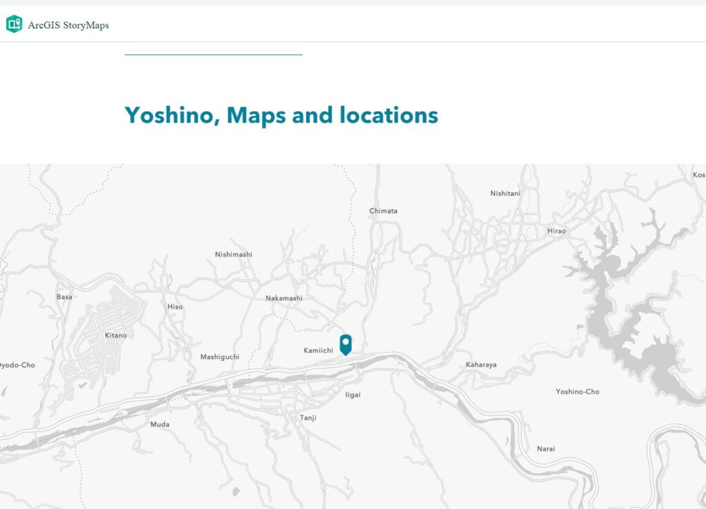
- The locations in this travelogue are all local spots that are very difficult to search and identity using the searching function in ArcGIS Online. Then I tried the “Express map” feature in the StoryMap, but I could only find “Yoshino, Nara,” as shown in the image below (Figure 1).
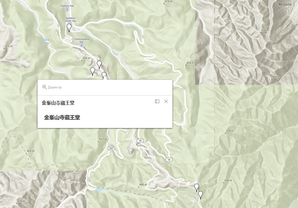
I was instead looking for another way to create a customized map that could show details of local sites. I made a map in Google Maps (location names in Japanese are available), downloaded its KML, and uploaded the KML file as content to my ArcGIS account. It works perfectly, as shown below (Figure 2).
I didn’t notice the limitations of adding non-Western spots in ArcGIS maps before trying it. As Sen writes in “Dividing Lines,” “for those of us whose corners of the world are considered ‘remote’ or ‘uncharted’ from an essentialist white, Western perspective, the interface is far from seamless.”
- We do not know whether the 37 poems in the manuscript are in chronological order. It is possible that the poet wrote poems one by one during his journey, but it is also possible that he took notes and went back home to finish the work. So, I did not mark a direction on the map but only provided spots he visited. In the StoryMaps where I can add more interactive features (e.g. Map tour), I thought it would be easier for viewers to navigate if I have an order, so I just did a demo following the poem order. But it would be an excellent question to consider the sense of time and geographical distance presented by textual materials in premodern times when we design an interactive digital map in which modern readers could explore the locations via a historical figure’s mind (or maybe also via the designer’s mind). This question is an idea that I can relate to Monmonier’s book How to Lie with Maps. Besides scales and symbols, directions and order of locations could also lie to us. Or if we use new orders as an interpretation of the original text, would it be an issue?
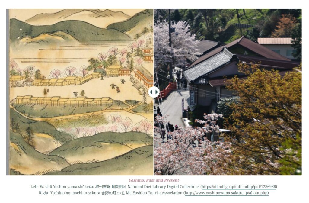
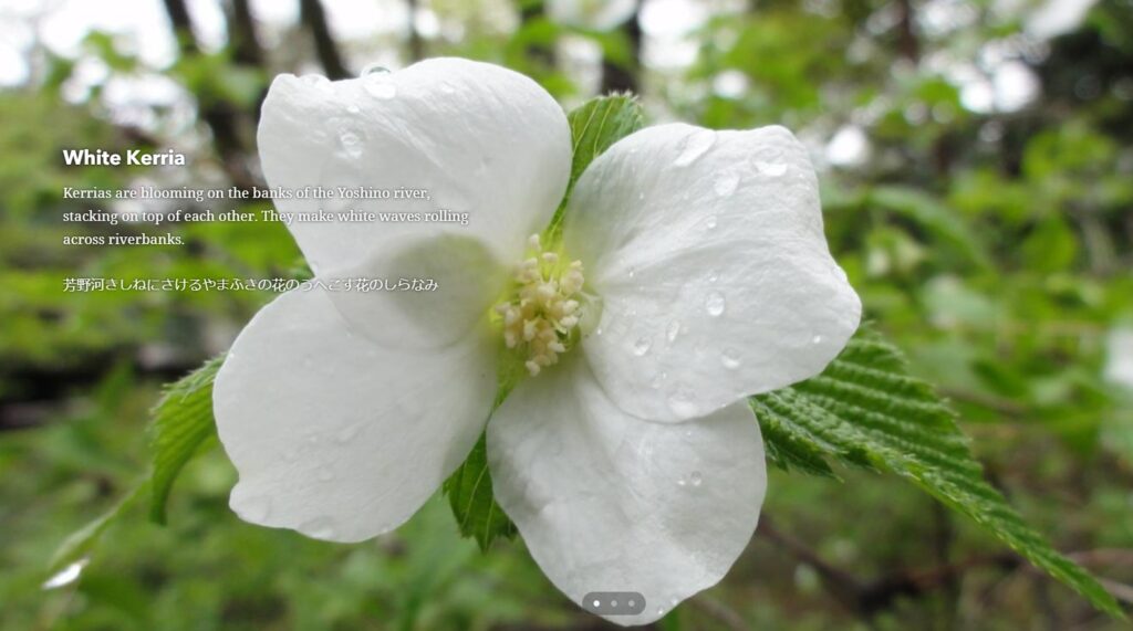
- I played with features like “Express maps,” “Slide,” and “Sidecar” in StoryMaps and thought these are great tools to create past-present comparisons and literary maps (content + geographical info). “Slide” is very interesting in that it allows two images to be overlaid and one can swipe back and forth. (Figure 3)
- However, since the account I used this time is public, many features are unavailable. For example, sometimes, I could not change the font/size of the text. Also, it was impossible to build a bilingual StoryMap in the past, but I successfully inserted Japanese text into my StoryMap this time. However, if I wanted to try further, I still couldn’t do the vertical direction for the Japanese poems. (Figure 4)
- Last, both the map and StoryMap could be shared by URLs. But the group function (members in the group could collaboratively work on one project) in StoryMap is not very user friendly. If I use a school account, it seems easy to find partners in my school and share a work-in-progress privately. But I see obstacles in sharing your project with members outside your school. On YouTube, you could upload a video as “unlist (more sharable than private),” but I haven’t found a level between “private” and “public” in StoryMaps, which makes teaching using StoryMaps in the classroom a bit challenging due to copyright concerns.

This entry is licensed under a Creative Commons Attribution-NonCommercial-ShareAlike 4.0 International license.
Miaoling,
Your post is so through with so much information about the tools that it makes me seem like a slacker for only attempting 1 tool. Maestra!