StoryMaps project: Bronx Untitled (2022)
Inspired by the maps and reflections the class made and, as I was finally able to go to a map workshop!, I returned and partially completed my own praxis assignment in StoryMaps about the Bronx. I attempted an affective mapping of my working-class, culturally rich and diverse neighborhood, plus a more “larger” curated view of the borough, plus a reflection on borders and shapes. It’s still under construction. I would love to continue the project and work with the community, with the owners of the shops mostly, and ask for their permission to take pictures and include them in the map. Maybe even do maps with them, if they have time, following mainly the methodology of “Talking Maps” as developed by Victor Daniel Bonilla. A Colombian author that constructed many maps with the Nasa community to create visual representations, maps, of their struggle during the 1960s as they continuously had to fight the Colombian government for sovereignty of their land. But their maps mainly tell the story of a Quintín Lame, one of Colombia’s most important indigenous leaders and activist. The class we had on maps also made me remember how much indigenous communities have resisted attempts at mapping, or at leas at maps created to control them, pinpointing their territories and use as a tool to continue our endless history of exploitation and extractivism. But, the work of Victor Daniel Bonilla was done with and for the community. The results are different, the process is different, the intention is different, is about memory, also about who gets to define your narrative.
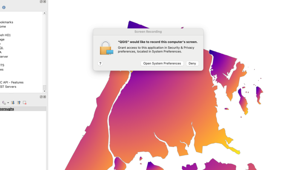
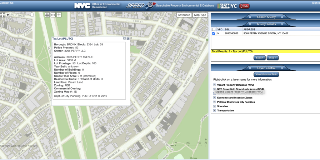
The photos I’ve included in the StoryMap “Bronx Untitled” where mainly taken by me (with verbal consent from the store owners) but some where also from other people’s blogs. I wanted to share a few things/questions that might resonate with those of us/you that want to do more maps. To situate the affective mapping theoretically I started reading “Affective Mapping: Melancholia and the Politics of Modernism” (Flatley, 2008) if anyone has reading recommendations please let me know! I found it useful to think alongside Yarimar Bonilla & Max Hantel (2016) piece on sovereignty. I also think an affective map could be a useful technique against the bad representation or imaginary that there is out there about a borough so huge and diverse like The Bronx. Then, thanks to the workshop in QGIS I was able to step a bit out of my framework and think with those geographical concepts like coordinates (x,y) of latitude and longitude, vectors (collection of those points), features (main information unit), attributes (information about a feature), layers and .sph files. I’ve got much much to learn and most importantly to think differently. But I found the workshop truly useful for a true beginner like me, I recommend it. Weirdly also while using the program at some point it asked me if I would give it permission to record my screen, does anyone know why this happens?
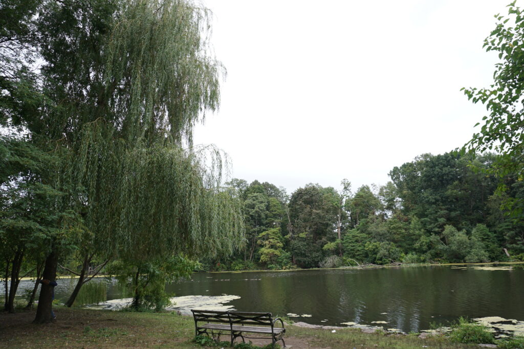
Anyways, in the process of creating the affective map I started to “see” certain things about my neighborhood that were new, like the idea that a lake that once was part of that region, before 1888, truly influenced to this day how we humans are located and developed our activities around space. Also, there are some “vacant” spaces here and there in the neighborhood. I wonder if this is neglected territory or is a strategy for gentrification by increasing prices on already overcrowded apartments?. But also, when thinking about space one should not say that something is “vacant” on those spaces there was so much life, birds, vegetation, raccoons, etc. The fact that a space does not have humans doesn’t mean is empty. In any case I was also “surprised” by the lack of information on this lots.
Like some of you I also wondered how could I represent something in space that escapes the x,y coordinates. I did a sketch of what/how I sometimes interpreted my neighborhood space, as a collision of unseen cultural borders. The neighborhood has a high rate of hispanics but there are also many people from Bangladesh and it was so interesting for me how my aunts and mom would not really shop on Halal stores even though they basically sold the same exact vegetables as the Mexican store and where literally next to each other! That always makes me wonder how maybe we carry invisible borders within our own existence, borders that mentally accommodate space in a very specific way. It’s not so much that I can’t go to the Halal store but there’s something informing my “hispanic” experience that prevents me from going, from choosing it instead of the more familiar looking store. And yet, there were moments that the neighborhood flourished in unique ways, whenever there was a special religious event, the colors of the street changed, the beautiful dresses inundated the streets with greens, blues, purples, golden colors and the jewelry tingling sounds coming and going alongside laughs. Anyways, how can you express that in a map? And why? I remember someone in class saying that those maps (or perhaps some data visualization) goes to the point of not being useful but just being a pice of art….
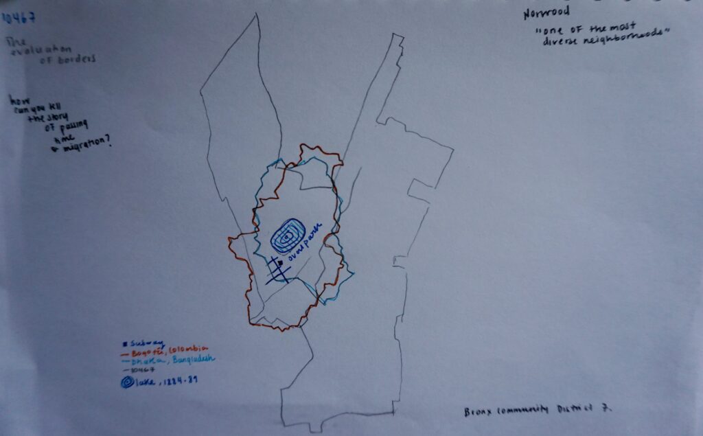
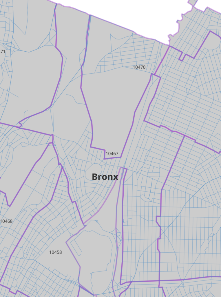
Something interesting that emerges from this two maps is how the neighborhood’s central park (once a lake) might or might be not connected to the larger flora and fauna of Van Cortland that gives Norwood it’s northern limit (according to official standards but in reality it feels more like an extension of the barrio) but it’s part of the 10467 Zip Code. Maybe, while analyzing this space through a more non-human centered view one might be able to connect this two rich and important bodies of life, vegetation and mental health relief. Van Cortland in turn, connects to other parks that eventually lead to the old Croton Aqueduct. Water is so important, maybe one of the most important layers for, yes, geographical thought but also for cultural thought.
If you want to talk about the Bronx HIT ME UP!
—Happy day & Thanks.

This entry is licensed under a Creative Commons Attribution-NonCommercial-ShareAlike 4.0 International license.